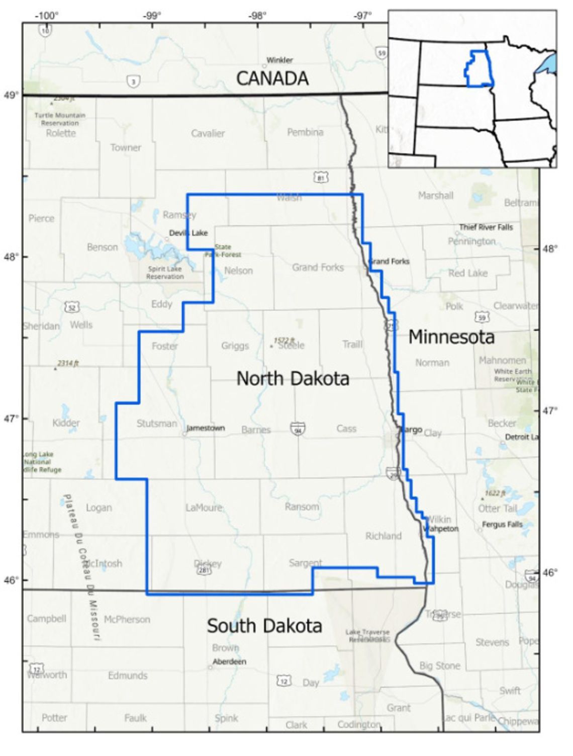
Residents in parts of northeastern South Dakota and southeastern North Dakota may notice low-flying aircraft in the area this summer and fall as the U.S. Geological Survey conducts an aerial mapping project.
The flights are part of a partnership between the USGS and the North Dakota Geological Survey to gather information about rock formations deep below the surface. The data will help scientists better understand the region’s geology, mineral resources, groundwater and potential natural hazards.
The survey will use small fixed-wing aircraft equipped with scientific sensors to collect magnetic and radiometric data. The instruments do not emit anything harmful, and no photography or video will be taken.
Flights will occur during daylight hours and be conducted by specially trained pilots working under Federal Aviation Administration regulations.
Aircraft will operate out of several regional airports, including those in Barnes County, Casselton, Kindred and Wahpeton, N.D. The survey area includes portions of Brown, Marshall and McPherson counties in South Dakota, as well as Dickey, Richland and Sargent counties in North Dakota and nearby areas of Minnesota.
The project is part of the USGS Earth Mapping Resources Initiative, a nationwide effort to improve understanding of the country’s geology and natural resources. Information collected during the survey will be made available to the public through the USGS.